Main Features
-
New Points:
Use this function to create one or more Points.
-
New Polyline:
Use this function to create new 3D-Polylines.
-
Edit Polyline:
This mode allows for intuitive editing of 2D- and 3D-Polylines.
It indicates dX, dY, dZ, dXY, dXYZ values.
-
Distance measurement:
This feature can be used to get the distance between two points.
-
Cancel (ESC):
Cancels any operation and resembles pressing the Escape key.
Useful on tablets without (overlay) keyboard.
-
Top view:
Rotates the view in BricsCAD to show the drawing in top view, without
rotating or moving anything.
-
change background:
Switches between a dark and a light background.
-
Open/Save:
This option is only available in combination with the AndroTec Geo-Data Converter and allows easy
Import/Export of plans to/from surveying file formats like CSV, TXT, Sokkia SDR33, Leica GSI, REB (DA30, DA45, DA4) and more.
-
Kubatura: This option is only available in combination with AndroTec Kubatura.
It launches the application within the directory of your current CAD drawing.
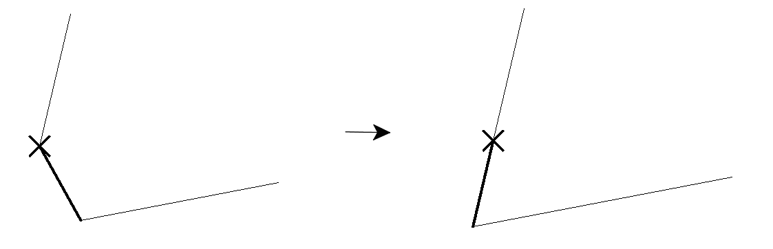
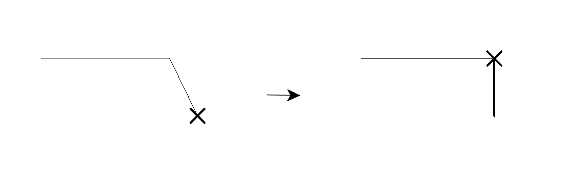
Intuitive Polygon Editing
- Selection of the control point to be edited graphically by mouse or by keyboard command
- In addition to the selection point, a selection edge is also displayed
- Functions for editing control points such as deleting, moving or adding
- Functions for editing edges such as closing, opening or inserting corner points
(by intersection calculation or perpendicular projection)
- Functions related to multiple polylines such as Split, Merge, or New Polyline
Teamwork with AndroTec TosCAD
Together with AndroTec TosCAD and the TosCAD protocol module, CadTool offers
additional functions for measuring points or polylines.
When new points/nodes are measured with the CADTool functions New points, New
polyline or Edit polyline, blocks with selectable attributes can be added automatically.
The attributes include information such as:
- Coordinates
- Raw data
- Measurement mode
- Coordinate offset
- Rod measure
- Prism constant (for total station)
- Point number
- Name of the station used
- Date / time of measurement
- Localization (for GNSS)
For more information, please refer to the instructions for TosCAD.
|